CT. Drone Headquarters
West Street, Cromwell 9-1-2025
Real Time Construction Progression
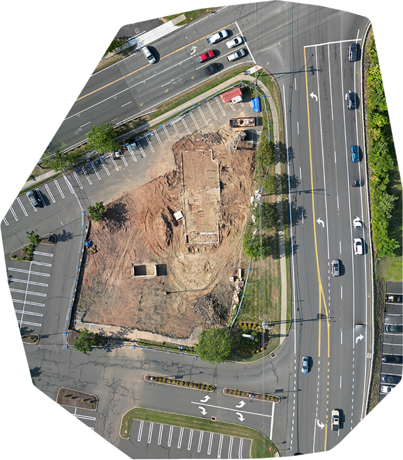
Before slider – August 16, 2025. Concrete slab is poured.
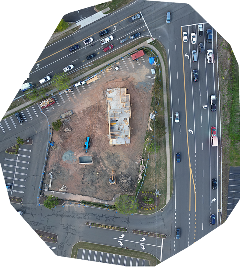
After slider – September 1, 2025. Wood framing started.
Click on slider to move up & down.
_________________________
With today’s technology, you don’t have to be on the job site to know what’s happening with your construction build. We use the latest drone data collection tools to keep you and your clients up to date with the job site through still imagery, video, and 2 dimensional modeling.
We create unique flight paths for your jobsite for still images, video, and image models that can be saved after an initial drone flight of your build location. Those flight paths can be re-used time and again. Whether you want to show day to day progression, week to week progression, or month to month, the saved flight plans can be used to follow the same video path, take photos from the same locations, and generate site models that match your previous flights.
In the end, this means you’ll be able to see the progress of your build on your own private custom pages here at CT. Drone HQ!
Still Imaging
With our saved flight paths, drones can visit select shot locations time after time to show the overall changes on your job site. Whether you’re looking to monitor your job site daily, weekly, or monthly, you’ll be able to compare the progress on site with a quick glance.

Drone HQ Disclaimer
While CT. Drone HQ is capable of aerial data collection, visitors should know that we do not interpret survey grade information. For projects where exact measurements count, you still need to rely on a licensed land surveyor or survey engineer.